Lee Peak
Koordinatar:
| Lee Peak | |
| fjell | |
| Land |  Antarktis Antarktis |
|---|---|
| Fjellkjede | Dronning Maudfjella |
| Topp | Ross Dependency |
| - koordinatar | |
| Administrert under | Antarktistraktaten |
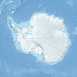  Lee Peak (Antarktis) | |
Lee Peak er eit fjell langs vestsida av Scottbreen, 3 nautiske mil (6 km) nord for Mount Denauro i Dronning Maudfjella. Det vart kartlagd av US Geological Survey (USGS) frå landmålingar og flyfoto tekne av U.S. Navy, 1960-64. Det vart namngjeve av Advisory Committee on Antarctic Names (US-ACAN) etter Frank P. Lee, ein fotograf på flyturar i Antarktis i løpet av U.S. Navy Operasjon Deepfreeze 1965, 1966 og 1967.
Kjelder |
 Denne artikkelen inneheld stoff som er offentleg eige frå United States Geological Survey-artikkelen «Lee Peak» (innhald frå Geographic Names Information System).
|


